RBDM v6.x
Riparian Buffer Delineation Model:
The RBDM v6.x is an ArcGIS Desktop\Pro toolbox designed to accurately and efficiently map variable-width riparian areas utilizing open source geospatial data. This new approach accounts for river/stream watercourse and its associated floodplain and is not influenced by variations in landform. Optional data can be used to provide comprehensive riparian area mapping and attributes such as riparian wetlands, riparian soil type, and riparian land cover classes.
RBDM toolbox defines riparian areas as "... a three-dimensional space of interaction that includes terrestrial and aquatic ecosystems that extend down into the groundwater, up above the canopy, outward across the floodplain, up the near slopes that drain to the water, laterally into the terrestrial ecosystem, and along the watercourse at a variable width" (Ilhardt et al., 2000).
The new RBDM model consists of three toolboxes with seven tools in total:
There are two versions of the new RBDM6.x for each ESRI ArcGIS software Desktop & Pro. RBDMv5.3_Desktop design is based on Python 2.7.13 and RBDMv6.1_Pro design is based on Python 3.7
-
RBDMv6.1_Desktop\Pro
-
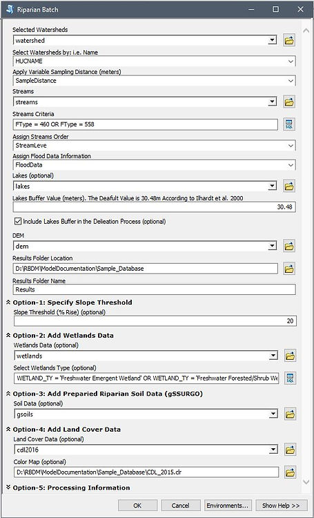
RiparianBatch: Processes watersheds within the targeted study area in a batch format and organizes results in separate FGDBs under watersheds names or a specific identifier.
-

for ArcGIS Pro
for ArcGIS Desktop